
Springer Mountain SOTA -- Did we bite off more than we could chew?
We’re getting well into autumn, and in addition to pumpkin spice lattes, the leaves are starting to change colors. For us, autumn is perhaps our favorite season. Living in Georgia, in addition to ushering in the holiday seasons, autumn also means a reprieve from the brutal heat and humidity. Over the past few weeks, the weather in Georgia has been ideal for getting outside – it has been sunny most days, with temperatures hovering in the mid 70s.
A few weeks ago (10/21), we ventured up to Tallulah Gorge State Park to see the autumn colors and to squeeze in a POTA activation (which was very successful!). From our conversations on the drive home, this probably ranks as the prettiest GA state park (in our opinion). So, coming off the heels of a successful POTA activation and a fun trip to the mountains, we spent the next week debating on whether we should go back to the mountains to see more fall colors and do another POTA activation.
The conversation went something like this:
KO4KVH
Hey, Tallulah Gorge was fun. We should
go back to the mountains next weekend and do that
again. I think Amicalola Falls state park will also
provide pretty views of the leaves, and we've never
activated that park before.
KO4KVG
I agree! Tallulah Gorge was a blast. Let's do it!
KO4KVH
You know, we've been running a lot, and I've also been
cycling a lot. I know it's a long hike, but if we got
there early enough, we could hike the AT Approach Trail
to Springer Mountain, do a SOTA activation, and then hike
back. The weather is going to be great. They're saying
it'll be in the 70s. It'll be a long day, but I think we
can do this!
KO4KVG
Ok... Maybe it won't be as bad as last time since I know
what I'm getting into...
KO4KVH
Awesome. Let's plan on doing that then. I know it'll be
a long day, but it should be totally doable. I think it's
only like 18 miles total.
With our plan to head to Amicalola on Saturday set, we planned to pack all of our gear on Friday night so that we could hit the road at 6 am on Saturday (it’s almost peak color season for leaves, and the parks fill up fast). However, Friday also happened to correspond with our 12 year anniversary, and after we got home from a celebratory dinner (which was awesome – Yellow Handi Indian Cuisine), it was a bit late to be packing. Thus, we didn’t really start packing until Saturday morning, which meant we didn’t hit the road until ~7:15 am. This delay doesn’t sound that bad, but it meant that we didn’t actually start hiking until ~10 am, and this will have implications for us further down the line….
After a quick visit to the visitor center to buy some park stickers and patches (since we knew we wouldn’t be done before they closed for the night), we finally hit the trail!
 KO4KVG standing at the start of the AT approach trail ready to get this adventure started.
Even at 10 am, it was warm enough that t-shirts were sufficient – no need for jackets. We started from the visitor center and headed toward the base of the falls, ready to climb all the stairs. Before we reached the stairs, however, we spotted many picnic tables right off the trail, which would be great to do a POTA activation from. However, as we had ~9 mi. of hiking left to get to the summit, we’d have to save POTA for another day. I couldn’t believe the luck of the weather: it was such a nice day to be outside.
Before we knew it, we quickly reached the stairs and started climbing, but we didn’t spend too much time admiring the falls – partly because we’ve seen them before, and partly because there were sooooo many folks taking pictures and we just wanted to keep moving.
 View of Amicalola Falls from the climb up the many stairs! We didn’t stay long because the stairs were extremely crowded and we had lots of ground to cover.
After we reached the top of the falls and really got started on the AT approach trail, traffic really thinned out. This was really beneficial, as we wanted to make up time on the flats when we had them! We did briefly pause and admire some of the views, which we definitely don’t get from our QTH. Even a few miles into the hike, we were feeling really good – the weight in our packs was distributed well (~30 lbs for KO4KVH, ~22 lbs for KO4KVG, including water) and was not causing problems, we both commented on how well the hike was progressing (which would come back to haunt us later), and we were enjoying the weather.
 Views of surrounding mountains from early in the hike
During our hike, we kept Ben’s HT (Yaesu FT-60R) on 146.52, and we kept Rebecca’s set to 145.800 MHz because the International Space Station (ISS) was conducting slow scan TV (SSTV) tests. We had just decoded Rebecca’s first SSTV transmission from the test the day before, and it was a lot of fun. We figured that if we could decode a transmission on the AT, it would be pretty neat! Sure enough, about 3 mi. into the hike, we heard the distinct sound of an SSTV transmission coming through the speakers of Rebecca’s HT! Rebecca grabbed her cell phone as fast as she could and opened the Robot36 - SSTV Image Decoder and then positioned herself to decode the image. Though we didn’t fully resolve the image, we were super stoked to be able to decode an SSTV transmission while on the AT approach trail.


(L) KO4KVG decoding an SSTV image trailside! (R) Partially decoded SSTV image sent from the International Space Station
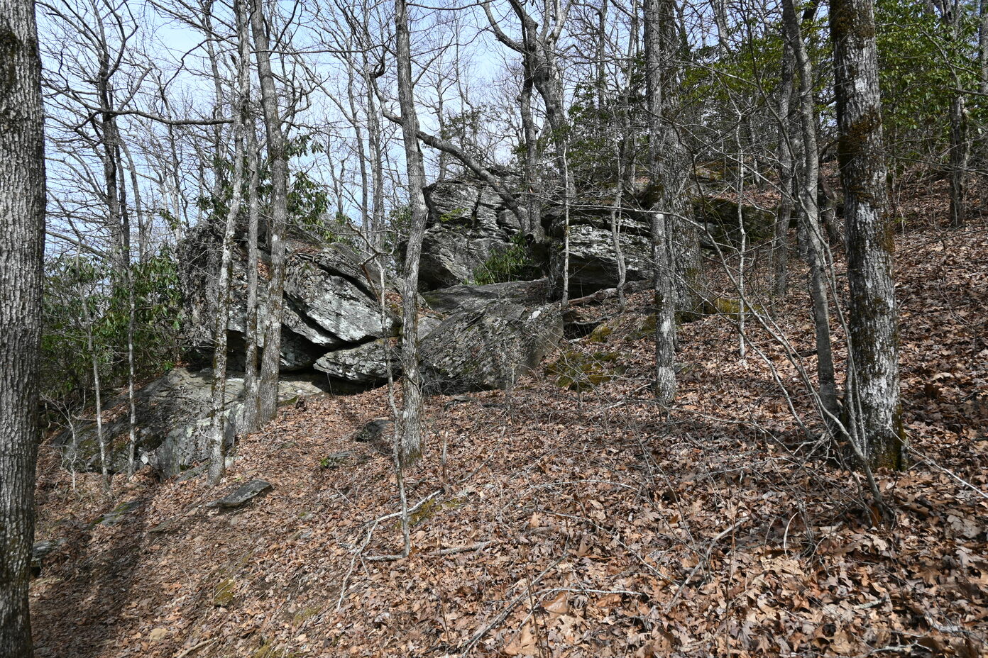
With another SSTV transmission under our belts, we continued our trek to the Springer Mountain summit. Remember how we commented that the hike was going really well and how great we felt? Well, that finally started to change about the time we approached the Black Gap shelter. Around this time, Ben’s left ankle started hurting (some Achilles tendon pain), so we slowed our pace to try to avoid hurting it further. The dispersed camping area around the shelter was packed (unsurprising given how nice the day was), but the shelter itself was closed due to problems with wildlife (we did not get to see a bear, unfortunately). We also started to make note of water sources because our water supply was starting to dwindle (by design – we did not want to carry excess water to save weight), but we decided to refill on our return trek.
The summit is not too far from the shelter (just a bit over a mile), but there is a pretty steep climb. We decided to just push through because we were so close, but Ben’s ankle was really starting to scream at him on the approach to the summit. As we’ve been to this summit before, we knew there was a nice area where we could spread out, so we just focused on getting there, with hopes that resting a bit would help us recharge. The climb to the summit was perhaps one of the quietest parts of the hike as we just focused on powering through to get a break so we could set up our station and make some QSOs.

 (Top) Elevation profile of the AT Approach trail as recorded using a Garmin Fenix 5X and uploaded to Strava.
(Bottom) KO4KVG on the final approach to the summit of Springer Mountain.
(Top) Elevation profile of the AT Approach trail as recorded using a Garmin Fenix 5X and uploaded to Strava.
(Bottom) KO4KVG on the final approach to the summit of Springer Mountain.
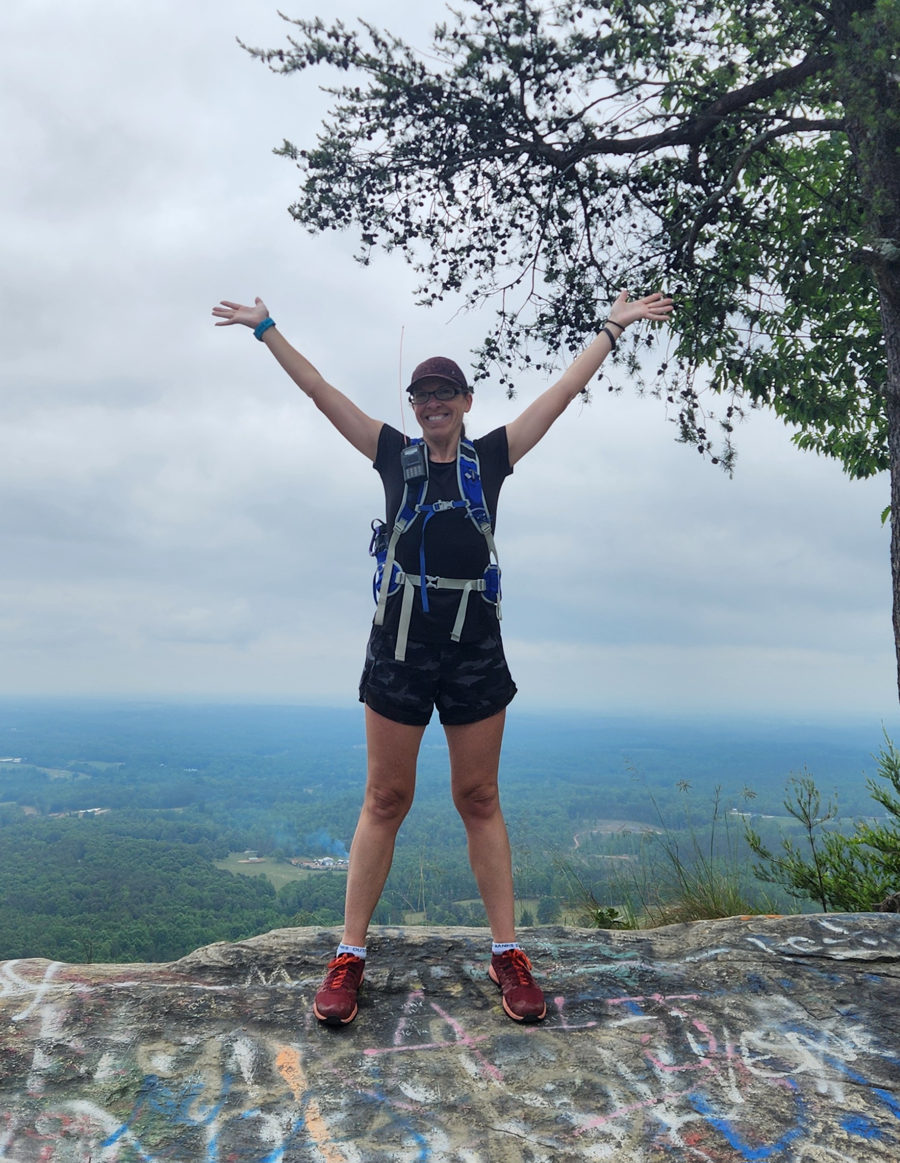
After reaching the summit, we took a couple of minutes to look around and admire the views, and more importantly, to celebrate being halfway done with our hike (9 miles done!). At this point, it’s worth mentioning that we were not actually halfway done because of a decision we’d make in a couple of hours that would have consequences down the road, but we’ll get to that… Once we felt like we’d sufficiently enjoyed the victory of summiting Springer Mountain, Ben started to hobble over to the clearing, and we threw our packs down and set our chairs up. Getting off our feet for a bit felt GREAT.
At this point, it is important to note that it was ~2:15 PM Eastern time, and we were pretty much resigned to be hiking back, at least some, in the dark. We briefly discussed the implications of this and decided to stay at the summit no more than an hour to minimize the amount of “night” hiking we’d have to do. We already knew there was a high probability that this would happen given our late start, and we were adequately prepared (headlamps + backups), but we knew hiking in the dark would inevitably slow us down. Thus, we quickly ate lunch (just some simple sandwiches and Pringles, because those cans are just great for avoiding broken chips!) and set up our stations. We started with our 40 m EFHW paired to a Yaesu FT-818, and we also put our roll-up slim-jim antenna and hooked it up to one of our HTs so we could also use 2 m for some VHF contacts.


(L) KO4KVG excited to sit down and have a late lunch! (R) FT818 operating on 40 m
On the approach to the summit, we’d heard some folks having a rag chew on 146.52 MHz, and unfortunately for us, this conversation went on for hours. The entire time we were on the summit, we never had what we felt was an appropriate time to break in to call CQ on 146.52 (had 2 m been our only option for making contacts, we’d have put a spot out on a different frequency and, had that failed, joined the ongoing conversation), so we decided to focus only on making HF contacts. We threw out a spot on SOTA Spotter and started calling CQ, and we were able to get a couple really strong QSOs on 40 m. Unfortunately, we only got a couple on 40 m, so we changed out the EFHW to operate on 20 m to get the last couple needed to count as an activation. Once we tuned into 20 m, though, we heard A LOT of traffic. Apparently we were overlapping with the CQ World Wide DX Contest, so finding a clear frequency to call CQ on was challenging. Remember how we realized we’d be hiking back in the dark? Keeping that in mind, we decided to pack up our station and head back. At this point, KO4KVG was 1 QSO shy of a successful activation, so KO4KVH took his HT and hiked outside of the activation zone to give her a quick 2 m QSO so she could also have a successful activation.
With everything packed up, we started our hike back to the park. At this point, it was pretty late (~3:45 PM Eastern; so much for staying only an hour!), and we still had to refill our water. On our hike up, we made note of water locations, and we decided the water location just past the Black Gap Shelter was going to be our best option, which is ~2 miles past the summit. We pushed pretty hard to get to the water location, partly to make up time. Once we reached it, we realized it was going to take a bit to fill up our water bladders because the water flow was on the lower side (North Georgia has been under drought conditions). However, the water was extremely cold, and honestly, quite refreshing!

 (Top) Water bladders ready to be filled.
(Bottom) Low water flow/volume due to drought conditions.
(Top) Water bladders ready to be filled.
(Bottom) Low water flow/volume due to drought conditions.
Filling the water bladders provided a small morale boost as we knew that we’d likely be good for water until the end of the hike and because the cold water did a nice job of quenching our thirst. However, we did not have much time to spend lingering at the water hole as darkness was fast approaching. Thus, we quickly resituated our packs and resumed hiking, albeit slower than we would have liked because Ben was still favoring his ankle, and Rebecca was starting to experience the onset of exhaustion.
After a while, we finally reached an intersection in the trail where it branches to the left to pass by the Len Foote Hike Inn and to the right, which is the way we initially came. We had heard that the path by the Inn adds approximately one mile of additional distance but has less elevation change and is thus somewhat easier. We briefly discussed what we should do, and we made the choice to go to the left, opting to increase the mileage in favor of reduced elevation change.
It wasn’t long into the trail that we decided we made the correct decision. The trail felt a little smoother, and it seemed like we were making decent time. The sun was beginning to set, so we quickly took in some of the last views. One of the nice things about this trail is there are also some bridges to help cross areas, keeping things even smoother!
 Bridges along the trail made crossing easier, which was much appreciated at this point in the hike!
Shortly after passing the Inn, two things happened: it started getting dark and the exhaustion really started to set in. We knew going into this that it was going to be a difficult hike just given the distance and elevation profile. We had definitely underestimated just how difficult it was going to be, and we did not fully account for Ben’s ankle hurting this early into the trek, which slowed us a bit more. Thus, it was finally time to break out the headlamps, knowing that we still had several miles remaining before we reached the state park.
At this point, it is important to note that we were prepared for multiple “worse case” scenarios. In our opinion, when venturing into the backcountry, even for well-traveled trails such as this, it is important to have adequate supplies and experience to be self-sufficient as “help” may be slow to arrive in the event of an emergency. In the backcountry, you may not have cell phone reception, so contacting help may be challenging. In our case, we had alternative communication methods (we are amatuer radio operators, after all). We also have a tendency to “overpack”, and also had adequate supplies should we need to set up a makeshift camp overnight (including first aid supplies and the knowledge to use them). Although parts of this story make it sound like we were headed for disaster, in practice, we were more subjected to discomfort rather than heading toward becoming another “unprepared hiker has to be rescued” statistic. Please plan accordingly before heading out on any backcountry adventure!
With headlamps on, we continued hiking, knowing that we still had several miles to go before reaching the park. Hiking in the dark definitely slowed our pace, especially because we kept stubbing our toes on rocks and roots in the dark. It also felt like the time from dusk to “complete” darkness passed extremely quickly! As soon as complete darkness arrived, we also broke out some chem lights, wearing them around our necks to make it easier to find each other should we become separated. The one reprieve, however, is that it was still warm even in the darkness, so we didn’t need to pause and break out an extra layer.
 Hiking in the dark with only the light of headlamps
We’re not going to lie, the last few miles into the park were tough. The combination of fatigue and frustration (specifically the constant bashing of toes into roots and rocks) was somewhat demoralizing, and the last few miles felt like an eternity. However, when we finally reached the point where the Hike Inn trail merged back with the AT Approach trail, it was almost like an adrenaline boost because we knew we were very close to the park. Shortly thereafter, we reached the parking area at the top of the falls, and we were extremely excited because we knew the end was in sight! At this point, we even took a couple minutes to recoup and bought a Diet Coke from the vending machine at the top of the falls as an additional morale booster. All we had to do was descend the 700+ steps and walk back to the visitor’s center. Little did we know that we were about to make a decision that would come back to haunt us…
 KO4KVG descending the stairs in front of the falls, in the dark!
About halfway down the stairs, we saw a sign that pointed to the visitor’s center. When hiking to Springer Mountain, we had taken the AT Approach trail from the visitor’s center, to the falls, and up the stairs. However, we talked about it a bit, and we incorrectly assumed that if the sign pointed to the visitor’s center, maybe this would be an easier, shorter path back. After a bit of deliberation, we decided to go this route rather than just directly retrace our steps. This decision was probably the worst one we made on this trip because we were not familiar with this trail and it ended up being very rocky and rooty, which caused even more stubbed toes and frustration. There were many times we questioned whether we’d ever make it back to the visitor’s center. This decision, coupled with taking the Hike Inn trail back, resulted in over two additional miles of hiking, which doesn’t sound bad on the surface but did result in over 20 miles of hiking for this trip!
Fortunately, after another stretch that felt like an eternity, we did make it back to the visitor’s center, where our truck was the only vehicle left in the parking lot. We quickly doffed our packs and slammed some water. It is difficult to put into words how we felt seeing the truck – it was quite the relief! Although more difficult than we initially anticipated, this ended up being a successful activation!
There were definitely some lessons learned on this trip, which can be summarized as follows:
| What went right | What we learned or should have done differently |
|---|---|
| We got outside on a nice day! | We should have adjusted our plans given our late start; perhaps parking at the top of the falls |
| We were “overprepared” in terms of supplies | At the end, we should have followed our original path vs. following an unfamiliar trail |
| We should have checked to see what contests were going on, making it easier to plan for QSOs | |
| We were a bit too confident and thus underestimated the difficulty of the hike |
Reflecting back on the trip, difficulties aside, it was still an excellent trip. We were able to make the most of a beautiful fall day and were able to really enjoy the scenery. Next time, we may not be as ambitious, but we always say that and still end up taking on trips of this magnitude ;)
Until next time, 73!
KO4KVH and KO4KVG